start: 12/06/2024 11:11:59.661
end: 12/06/2024 11:11:59.672
11ms
Technical Support to the Royal Bahamas Defense Force
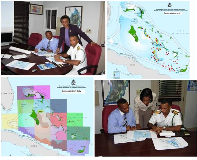
At the request of Officers from the Royal Bahamas Defense Force (RBDF), the BNGIS Centre provided a demonstration on how GIS and associated technologies could be used for spatial marine management including border protection/patrol, mapping incidents at sea, and many other applications.
The expressed interest of the RBDF to use geo-technologies resulted in the organization being issued a user needs assessment as a first step to planning ways of integrating GIS applications in its operations.
mof_content/internet/BNGIS/Government/Technical Support/Technical Support for The Royal Bahamas Defense Force/Technical Support to the Royal Bahamas Defense Force
Technical Support to the Royal Bahamas Defense Force
start: 12/06/2024 11:11:59.684
end: 12/06/2024 11:11:59.714
30ms
mof_content/internet/BNGIS/Home
Home
start: 12/06/2024 11:11:59.714
end: 12/06/2024 11:11:59.715
1ms
mof_content/internet/BNGIS/Government/Technical Support/Technical Support for The Royal Bahamas Defense Force/Technical Support to the Royal Bahamas Defense Force
Technical Support to the Royal Bahamas Defense Force
start: 12/06/2024 11:11:59.715
end: 12/06/2024 11:11:59.720
5ms
